Many hours (I still need to add it all up) and ground exams later, we finally reached the day of the Skills Test. The only point where you’re actually examined in the air for your ability to conduct a safe flight with sufficient competency to be trusted with passengers who potentially have never been in a light aircraft before. Obviously, completion of other training (Qualifying Cross Country), shows ability for getting from A to B to C and back to A again, but the skills test is where you demonstrate essentially everything you’ve learnt, in the air, to an examiner.
Arrival and Checkout
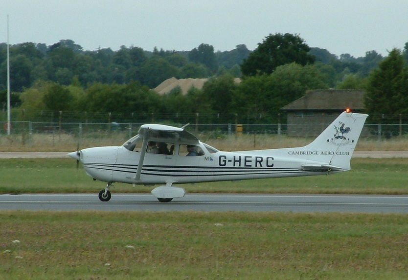
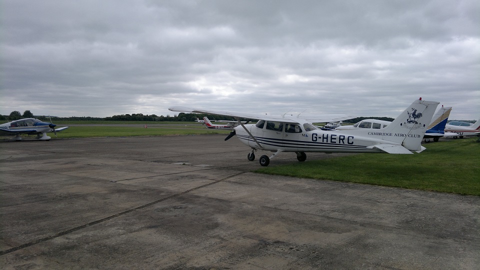
I’d agreed with the club to have G-HERC on the day, so it was fully fueled up the night before avoiding any fuel issues in the morning. What could go wrong?
I got there early, agreed with the examiner I’d go and check the plane and come back in – it seemed like a good plan and I felt ahead of the curve so far. Having lowered the flaps and in the process of walking round the plane giving it a good check out, I noticed the examiner coming out to see me – unusual at this point. So I figured I’d save them a walk and meet half way, ducking under the flap I asked if all was ok?
We can’t take G-HERC, the Attitude Indicator isn’t working…
Ahhh great, the plane I’d done my First Solo and Qualifying Cross Country in, had gone and let me down 🙁 As I turned round, a little demoralized…
BANG!
In the distraction I’d forgotten the flap was now about 5″ lower than normal and walked straight into it, cutting my head open! A lovely cut, complete with bleeding, as you might expect walking into two sharp, hard pieces of metal would give you.
There’s a first time for everything, but I could have lived without bleeding before even starting the exam!
Time to get Another Plane
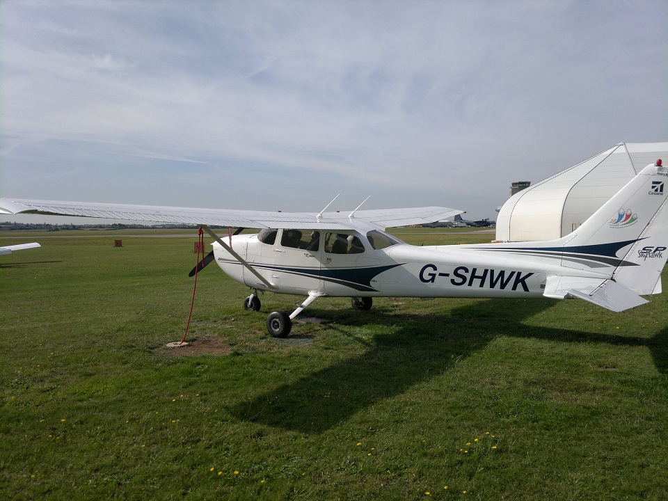
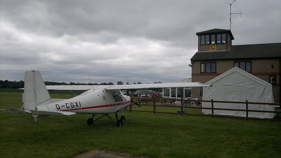
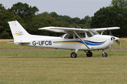
G-SHWK
Without the Artificial Indicator (AI) we wouldn’t be able to do the part of the exam that tests basic instrument flying – well actually more your ability to get out of an instrument flying required condition (i.e. unintentional flight into cloud). To intentionally fly on instruments requires more exams.
So we’d take G-SHWK.
…..but of course it’s only got 20 gallons of fuel and we need a minimum of 30, so I get to do a spot of free taxing to the fuel bay, before going for a briefing on the exam itself.
Examination Briefing
Firstly a recap that this isn’t an exam to test if I’m the best pilot in the world (probably a good thing as my head had only just stopped bleeding). It is about assessing if I can operate a piston single engined aircraft in such a way as being conductive of safe flight, from start to finish and sufficiently able to be trusted with passengers. Or generally words to that affect.
The examiner then outlined broadly what would be on the exam and how it would be structured (not surprisingly very much inline with EASA guidance):
- The examiner would act as ‘Someone who’s reasonably knowledgeable about aircraft, but cannot fly themselves’ – as such unless instructed: Control of the aircraft, Navigation and the Radio would be my responsibility.
- Navigation with a route consisting of 3 legs.
- Somewhere on the second leg I’d be given a simulated problem/emergency and would need to determine a good course of action (i.e. diversion) – without significantly deviating from heading or altitude while planning the action to be taken.
- On completion of the diversion there would be aircraft General Handling section covering:
- Instrument flight out of simulated cloud (i.e. Rate One turns / Heading & Altitude holding with reference only to the instruments).
- Recovery from a Spiral Dive
- Stall Recovery in the Clean Configuration, Turning onto Final and Final Approach Configurations.
- Steep / Advanced Turns (360 degree turns, with Turn Angle > 45 Degrees)
- Slow Flight
- Practice Forced Landing
- Precautionary Landing
- Radio Aid Position Fixing (using any aid of my choice in the aircraft except the GPS)
- Returning into the Circuit
- Normal Circuit / Landing (Touch N Go)
- Flapless Touch N Go
- Precision Landing
- Aborted/Rejected Take Off
That was the general outline, it was made quite clear that if the examiner was happy with how an item was carried out we’d move straight onto the next item and if he wasn’t we might need to do it again or a variant of what was asked – again not looking for total perfection across the board, but I assume there’s scope for a little bit of “Ok that wasn’t brilliant, but I can do……..really, see…..”.
The Navigation
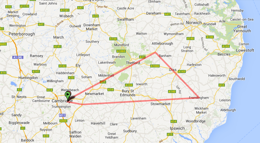
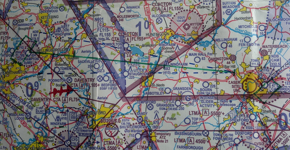
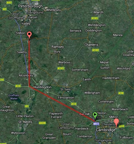
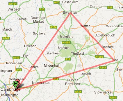
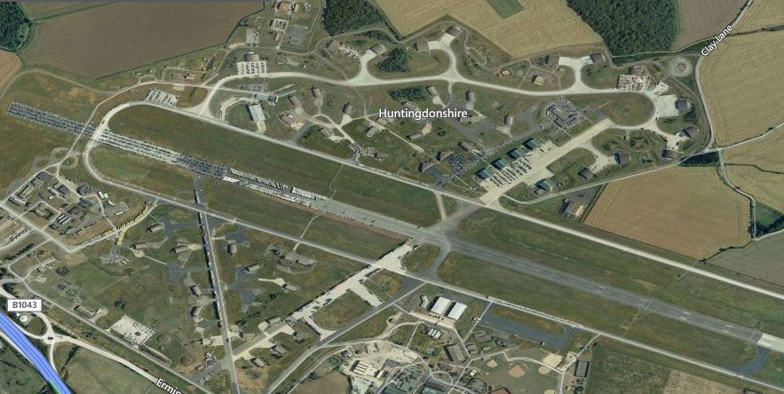
The route I’d been given to plan was Cambridge -> Bourne (Linconshire) -> Downham Market -> Cambridge.
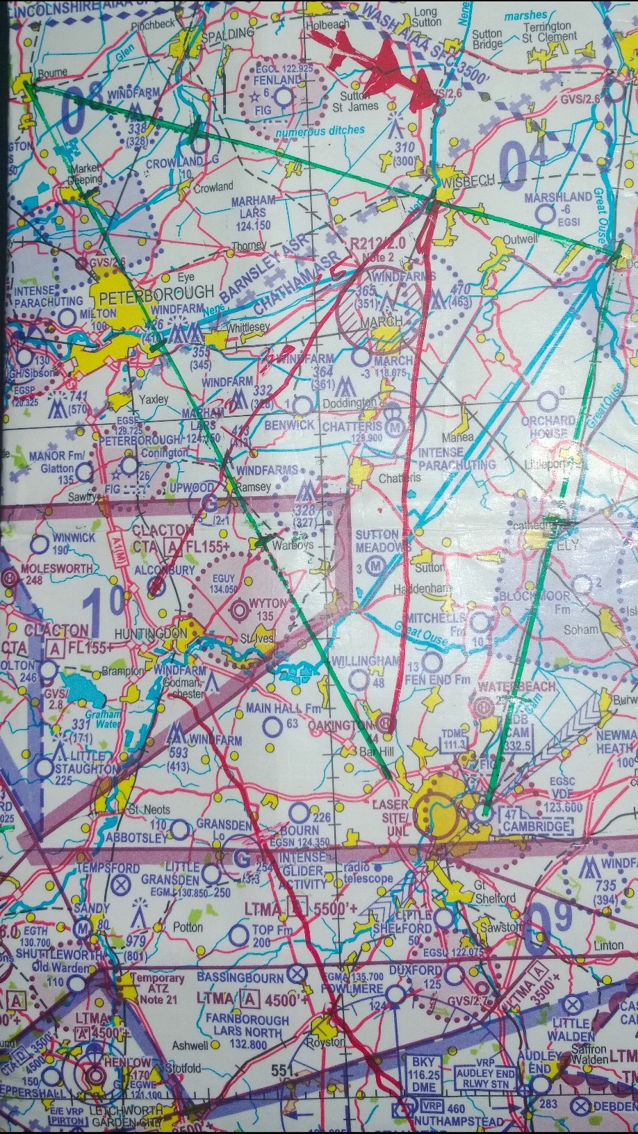
Skills Test Nav Route
Plotted on my navigation chart, it looked like this:
Some obvious catches to this route:
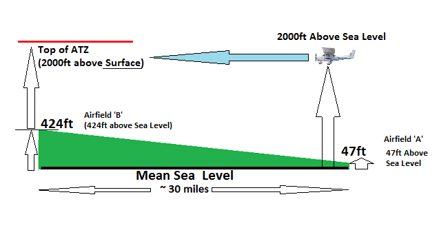
- Puts the plane very close to Wyton Air Traffic Zone (ATZ)
- Requires flying through Wittering Military Aerodrome Traffic Zone (MATZ)
I thought a lot about the Wyton part, all going well my intent was to call them up and let them know we’d be close to their ATZ – but as a backup safety measure so the flight definatly didn’t break any rules and couldn’t be argued unsafe. I elected to fly the first leg at 3,000ft.
The reason for this being that Wytons’ ATZ goes from surface (135ft about sea level), to 2,000ft above the surface.
By flying 3,000ft above sea level, I’d be at least 800ft above their ATZ. Well clear even allowing for minor pressure setting and other such errors etc.
On turning over Bourne, my plan would be to descend to 2,500ft. The intent here being that I’m more familiar with flying this area at this altitude so my perspective of distances on the ground would be better and that might help my Nav. there’s not a whole lot in the way of visual references on the second leg for the first 15 or so miles.
The obvious diversion point on the second leg would be Wisbeach, but the question was where would we divert to.
Booking Out & Taxi
It might sound bizzare, but one of my biggest fears was getting the paperwork on the ground right. Almost every lesson this is filled in by an instructor and so I was just waiting for this lot to go wrong. In the end it was all a non-event. A lot like the worry about debating the weather: On this day, the weather was unquestionably fit for flying.
Having filled out my booking out form and loaded it into the fax machine, it was time to see if G-SHWK had been topped up with fuel.
Clear Prop!!!!
It’s not typically taught at this club, I’ve always assumed because it’s such a large aerodrome, but in the last few lessons instructors had suggested I shout it anyway on starting the engine. For the sake of sounding a bit daft with absolutely nobody around, I shouted it out of the window regardless.
It started first time, things were going well and G-SHWK, easily my favorite plane to fly, was feeling right at home.
That was of course until I called up the Tower for permission to taxi. Then it all took a turn for the worst, as Air Traffic came back and said they hadn’t got our booking details…….I don’t know how, but I guess the fax didn’t go through (thankfully the examiner had seen me do this so there could be no doubt I’d done all I could). Had they got it, I’d made it very clear that this was a Skills Test (a hint to them in hope they’d be nice to me on returning to Cambridge where I’d want to do all sorts of strange circuits) – I guess fate had intervened on that plan. I’d have to book out over the radio, something I’ve done very rarely.
I’d expected I might have to demonstrate a short field take off, but on this day in history, it wasn’t required so flaps up for take-off and I took care to talk the checklist out loud just to be sure there could be no questions.
Navigation : The First Leg to Bourne
On lining up with the runway, my last question has always been “Are you happy with everything?” Today was no exception and perhaps while less valid then when with instructors, I find it’s still a relevant thing to ask…..last chance, in 2 minutes we’re going to be 1,000ft above the ground.
Full Throttle and the 172 began its charge down the mile of runway.
A little bit of crosswind as it lifted off, really nothing eventful, but I could hear my brain begin the chatter of “Now be good to me, I don’t need this….” the nerves had been at zero but with every bump of turbulence were building. A good time to run through the after take-off checklist then, get away from this mind game and back to my training: Engine Temp & Pressure in the Green, Mixture Rich, Landing Light OFF.
Climbing out at a nice 80 knots, at 1,000ft I purposely lowered the nose in the climb – don’t want to get chalked up for a bad look-out in the climb.
If anything I flew further south then normal, I wanted to be really sure that when I started the turn, it was at a reasonable height over Cambridge (as you’re not allowed to overfly it below 2,000ft). Having been drilled on a practice skills test to lift the wings before turning, I made sure to correct that as well.
Now to begin a climbing turn up to my declared 3,000ft altitude for this leg and find Point Alpha (where the M11 meets the A14).
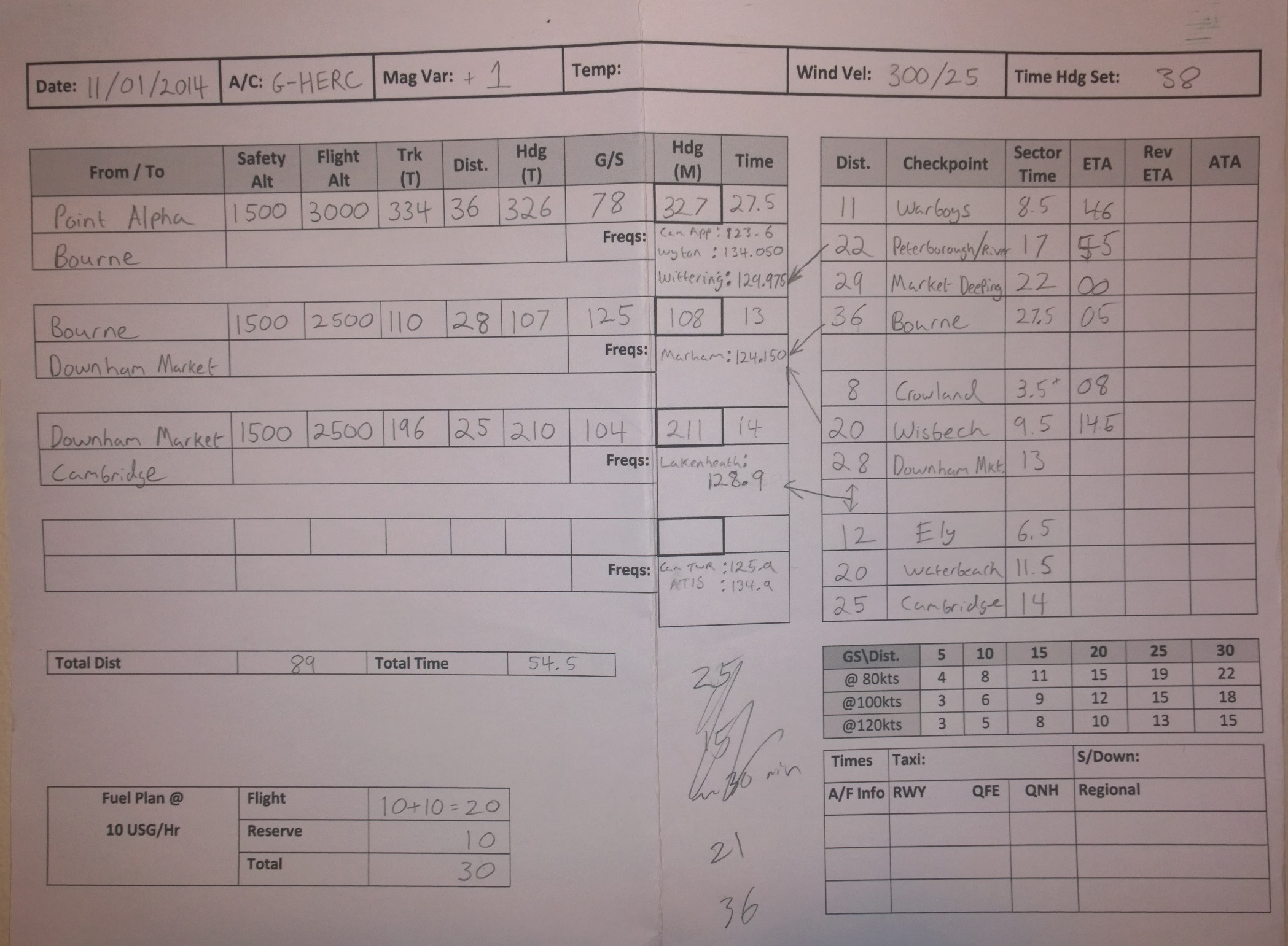
Skills Test : PLOG
Notice even my Pilot Log for the trip had been marked up for G-HERC, that’s how last minute the change was…….the arrows are visual cues to remind me of radio calls, the rest is scribble from the flight 🙂
The Heading Indicator Problem: Again
I’d had a major issue with the heading indicator on my practice skills test, the knob hadn’t fully released so the gyro had a limping effect (the heading indicator still turned, just not accurately). This had lead to being off course by ball park 30 degrees – a huge error in heading. My plan to avoid a recurrence of this issue was three fold and thus fool proof – or so I thought:
- I’d take G-HERC, it’s heading indicator is automatically aligned.
- I’d make absolutely sure none of the knobs were stuck on pre-check.
- En-Route to Point Alpha I’d check it was aligned with the compass, so any issue wouldn’t come unstuck post setting heading.
Item 1 was blown out of the water when HERC decided to develop a fault, so we couldn’t fly it. I’d set and re-set the heading indicator in SHWK on the ground and had been more than happy nothing was stuck or mis-aligned. As for point three, well I just forgot, in the climb I hadn’t calmed down until the after take-off checks and in the climbing turn I found myself worrying “What if I don’t see Point Alpha today???”
The moment I’d turned onto heading for Bourne, I began a FREDA check (and thank god I did!).
- Fuel – we’d took off with 53 US Gallons……the gauges said we still had the vast majority of it.
- Radio – we’d switched to Cambridge Approach, we had a basic service from them.
- Engine – Temps & Pressures in the Green.
- Direction – We’ve turned on to the correct heading and the heading indicator is aligned with the compass……wait a minute, no it isn’t, it’s off by like 10 degrees!!
All of this was said out loud, including a spoken realisation that my heading indicator wasn’t aligned. We’d flown maybe all of 0.5 a mile from Point Alpha, I’d caught it soon enough that all I needed to do was was reset it against the compass, correct my heading and then any minor course error I’d correct at my first reference check point. Pheew! That could have become a real mess.
- Altitude – I’d elected to fly this leg at 3,000ft, we were at 3,000ft on the dot and the QNH was set from the pressure provided by Cambridge Approach.
A nice heading and altitude hold for the next 20 or so minutes would see us arrive overhead Bourne. All that lay in the way was to decide if I was going to radio Wyton, any drift corrections and of course talking to Wittering to get permission to penetrate their MATZ.
It’s pretty easy to see Wyton, it’s a big runway and so on this basis I was happy I wasn’t going to fly straight through their ATZ but at worst skirt the edge, I decided to not overload myself with radio calls and not call them. Pilots and the books might argue this is bad airmanship, on any other day I’d agree, on this day I fell back on the golden rules of “Aviate, Navigate, Communicate.” Talking to Cambridge, then to Wyton (who maybe they were there, maybe they weren’t), only to have to switch to Wittering 5 minutes later at the time felt like it was tempting fate to cause things to go wrong, so I elected not to.
A slight course correction (0.5 mile) over Ramsey was required, I talked my actions through out loud so it was clear I wasn’t just wandering about the sky but intentionally repositioning over Ramsey. One of the nice things about this place is that there’s a mast/single wind turbine on its northern edge, this makes it a very distinctive place – identifying the mast and familarising myself visually with Ramsey now, would pay dividends later in the trip.
Calling Wittering
Ahead of Peterborough it was time to call up Wittering and see about permission to fly through their MATZ. As the stars would have it though, this wouldn’t be without its difficulty.
Firstly Wittering didn’t reply, then the reply that came wasn’t a military controller. The best theory decided later was it was probably the glider site.
Wittering weren’t there, so we wouldn’t be getting a basic service off them. Legally you’re allowed to fly though a MATZ so we could carry on. The examiner asked what sort of service I could now expect to have? I replied and alerting service…..would you really get this from a glider site? Who knows, what I know is the books say if you’re in radio contact with any sort of ATSU, even ground/radio service, then you should expect to have an alerting service (basically if you disappear or report an emergency, they should alert the rescue services for you).
Coming up over Market Deeping, I called out the land marks I was using to visually identify it (the shape, the river, the road to its west and the time overhead – all those things agreeing meant it was highly unlikely to be anything else). Time for another FREDA check…..we’d soon be over Bourne.
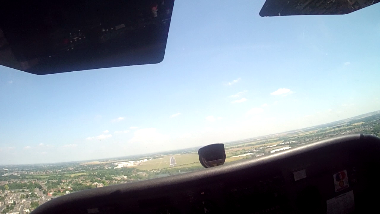
Overhead Bourne
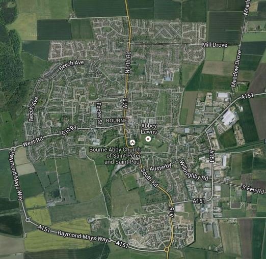
Bourne Overhead
Before setting off I’d done a bit of flight prep: What does bourne look like from overhead? (Google Earth is your friend). This had told me it had an industrial area to the south, a very handy visual feature.
Announcing that I knew bourne had an industrial site to the south and could see the town we were about to be overhead had this feature, there was a road going south/north and the times were correct. Thus this was bourne.
The examiner seemed happy and agreed on our location. So I was instructed I could make my turn for the second leg as/when I was ready to do so.
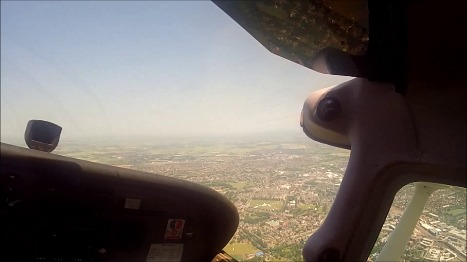
Navigation : Second Leg to Downham Market (Maybe)
The EASA guidance paperwork says there’s going to be a diversion in the test, the examiner had said this was likely to come in the second leg. So I had a good idea what was coming, I just didn’t know when.
My only concern on this leg was that I’m not the biggest fan of flying in this area, it’s a lot of nothing, fields as far as the eye can see. So it’s easy to go off course and have little opportunity to correct it early, but it was in my Qualifying Cross Country flight, so I’ve been here before and it does come good, you just need to keep things calm and work with what you can see, not what you want to see.
I’d gone round in orbits on a practice finding Crowland airfield, so I knew where that was at least.
Approaching Wisbeach the diversion came.
The clouds are lowering to the east, you won’t be able to continue on this leg and you can’t go north as the clouds are lowering there too. So I want you to plan what you’re going to do next, without significant heading or altitude deviation…..
The diversion I heard was “Oakington”, I drew this up on the map, planned by heading and off we went. Announcing a heading of 185, turning over Wisbeach
We flew this for maybe 4-5 mintues, because another query from the examiner:
Can I see your map?
I thought I must have done something significant wrong, but what could it be, south was the way to go if you wanted to get to Oakington from here. It would soon become clear.
“I’d actually said Alconbury….”
My map was my saving grace here I think, because I’d marked it up as a diversion to Oakington, my heading was correct to get me there and my ETA was right for there. It was obvious I’d mishead the destination, I guess the “Alcon” sounded like “Oakin” in the noise.
Turning round and heading back to Wisbeach, we’d do that again only this time routing for “Alconbury”.
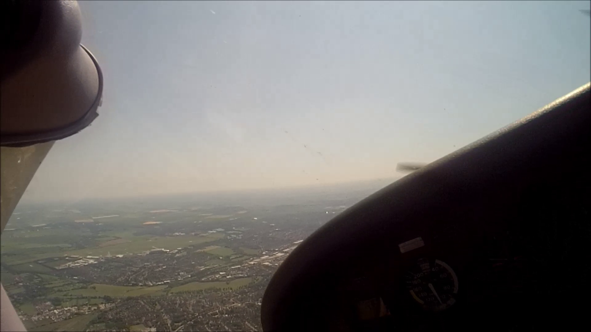
Navigation : Diversion
Many lessons ago, diversions were my curse, I’d find myself losing my location and then forcing the map to fit all sorts of desires on location. Today had to be better.
We’d clip the end of the river Nene, a good land mark, so I marked the time overhead. Should it all go wrong I knew when I was here and so how far away I could possibly be.
I was trying to talk through my thought processes so that the examiner could hear why I was doing everything I was doing.
Approaching Ramsey, the plan said I should be clipping its western edge, but its tell tale mast made it very apparent it was on my right hand side. We were left of course, approx. 4-5 miles.
A runway came into view ahead of us, as Alconbury is disused and this wasn’t, it couldn’t be Alconbury, so it had to be Wyton. Time to correct, at 2,500ft we be borderline to fly over Wytons ATZ and if we did that we’d be overshooting the destination anyway.
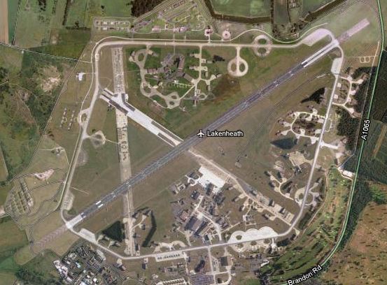
Alconbury in sight
……..much thanks to the instructors who’ve taken me there in the past, I’ve never been so thankful to see rows of containers on the end of a runway.
Alconbury Airfield (Disused)
Navigation Complete : Time for the General Handling
An announcement declared the the navigation part of the exam over.
All in all at this stage I was feeling pretty good about how it was going: We’d got to where we wanted to be, I wasn’t feeling utterly lost and we’d got here without me ever feeling a sense of panic or uncertainty about where am I? You can’t ask for much more than that.
Of the tasks that remained, only the Practice Force Landing was a real worry.
Instrument Flight
Kicking it off, time to put on the Froggles to demonstrate I could fly a heading & altitude with sole reference to the instruments and perform a ‘Rate One’ turn.
Now I could fly all day with these things on – I’m not saying it’d be legal or wise to do so – just that I’m very at home with discarding all natural sensations about which way is up and flying on the instruments. Always been quite happy with this idea and trusting that they’re not likely to lie (unlike the fluid in your ears).
All good and I don’t think there was any scope for dispute on this part, so we moved on.
Spiral Dive
I can be honest now, when I got told this would be on the list my immediate mental reaction was “Can I remember how to recover from one???” Of course, you can, but there’s likely to be something that you just begin to doubt and ponder.
To tackle this problem, I decided waaaaay back during pre-flight, that when we got to this I’d I was going to talk out loud the recover procedure. At least if it didn’t look brilliant, I’d be demonstrating I knew what to do 🙂
- Throttle Closed
- Opposite Rudder to the direction of the Spiral Dive
- Unstall the Wings
- Roll Wings Level
It seemed to do the trick, the plane recovered, not much height loss……we moved on. Phew!
Steep Gliding Descent
Pardon me? A what? 2,500ft up was not the time to be hearing about maneuvers that for the life of me I didn’t recall being on the training course.
You can’t just turn around and go “What the heck is one of those then?”
So we’d have to generally make up a maneuver that was: Safe, Gliding and Steep.
Safe: an airspeed greater than something that’s going to stall, but slower than 100 knots sounds about right. Gliding, easy enough, close the throttle and your gliding. Steep, an angle of bank greater than 30 degrees usually ticks this box.
It would draw a comment back on the ground, but only because I did it at 80 knots and perhaps 70 was better, but the examiner said it ticked the box and the airspeed was safe etc. Fair enough, as far as this part of the exam was concerned : Job done.
Advanced (Steep) Turns
Back into my happy place, I can do these, lets just crack on…….once round to the left, keeping my eyes as outside as possible, occasional glances to make sure the altitude wasn’t going beyond +/-50ft and completing back on the altitude we started at. Once round to right.
All good, we’ll move on then.
Stalling
The examiner said he wanted to see a couple of different stalls, from memory:
- A fully developed stall, recovering on his instruction.
- A stall in the base configuration, recovering at the first sign of the stall.
- A stall in the landing configuration turning onto final.
I had a mental moment of “right you are, off we go then….” before the voices in my head kicked in:
HASELL : Checks!!!
DON’T STALL without doing this first, it’s very likely to be a fail and I’ve done that “do as your told and try and do it as soon as possible” thing before. Not today.
No problems on any of these, I’ll never be sure if I was premature on the first sign of the stall turning on to final, but to rule out any doubt I said “buffeting” and recovered. It might have been in my head, but the second I felt something non-smooth flying like, that was good enough time to recover for me.
No drama at all and it was on to the next task.
Practice Forced Landing
I’m sure most people worry about this one, many an article in magazines or on websites from examiners will say this is a pass/fail moment – with not much scope for anything in-between. Convince them you’d land in the field = Pass. Else probably a fail 🙁
- Will there be a good field?
- Yeah but how good…..there are fields and then there are fields…..
- Will I actually see it?
- Which way is the wind coming from again?
All the usual worries going through my head, but you don’t know when they’re going to cut the engine.
When it happened I set the airspeed, 70 Knots, then it was a searching game…….find a field, try and fly with a tail wind (it’ll maximize the number of fields you can actually reach). In the end I settled on what didn’t look ideal, but was the best I could find.
An ok entry into a circuit formation of the field, an ok field, still would have liked something longer and I wasn’t going to be able to fly it fully into wind. Still, we’d make it, time to get in a few restart checks. No joy, so throw in a practice mayday.
Hmmm, that field is looking a bit further away then I’d like. Holding off taking the flaps, altitude 700ft and higher then I’d like, but if we take the flaps we’d not reach the field. This could be better, but it could be a lot worse. 650ft, we’re still high but I’d give it 70% we’d make that field. 550ft, I’d give it 60% we’d make the field, it’d take the flaps now and might require a side slip but it’s not beyond reasonable doubt we could make it.
……not beyond reasonable doubt indeed, but we can’t go below 500ft, so the jury was out on this one. Time to climb out of it.
Normally I don’t think you’d get another go at this, but on this day in history, there was sufficient doubt that it was arguable we’d have made it. Maybe it was that reasonable doubt, maybe that plus perhaps the rest had been good enough to let me have a “convince me” chance……one last go to convince the examiner that the first was ok, and any other go would be better.
Cutting the engine, I was going to get it as near perfect this time round.
Sure enough, coming through to 500ft, it was now unquestionable : We’d make that field, it would be a good landing.
Time to move on…….thank god for that, I couldn’t be sure we’d passed this, my only comfort was we were moving on and not returning to the airport – that had to mean something, right?
Precautionary Landing
Not quite what I’d have wished to move on to though.
Let’s just cut to the chase and say this could have been a bit better, instead of doing a 3rd approach at 50ft above the ‘virtual’ ground. I decided I was burning a lot of the examiners time and declared it would be to land on the 2nd approach.
Ok and the field was ok, but I’d get comments about it on landing.
Radio Aid Position Fix
I’d been dreading this, so much so that I’d had trips up prior to the exam just to practice I could remember how to do this.
Maybe thirty minutes had passed, but it wasn’t rocket science to know we were in the ball park area of south of Alconbury, so this would help with a gross error.
Using the Barkway VOR/DME, I dialed in the frequencies on Nav #1 and the DME, then Identified both stations. All good, now just to find what radial of the VOR I was flying on/from and read off the DME distance and we should have a fix.
330 degrees from Barkway, 15 nautical miles.
That would put us just a little south west of Bourn then, I could believe that.
So could the examiner, jobs a good one.
Intercepting the 115 radial proved to be a little more tricky, but we got there…….by the time we did, we were bizarrely south of Cambridge Airport.
Rejoins & Circuits
We were so south, that for the first time I can ever remember, it made sense to ask ATC if we could join downwind. This is where I was wishing they’d have got my fax, if they had they’d have known I was on my skills test and might be favorable……now I’d just have to hope the tides of traffic were calm.
Thankfully all was well, we could head straight in and join on the downwind leg.
Three circuits and we’d be done:
- Normal Circuit / Landing (Touch N Go)
- Flapless Touch N Go
- Precision Landing
The first the examiner said was aimed/intended to calm down on, sounds like the voice of experience. After 2 hours in the air, it was a voice I was very much in tune with. I was starting to feel somewhere between mentally fried and over-charged, with a touch of nerves now very much at the back of my mind. Calming down was what I needed to do.
I can’t remember the exact winds, but it felt like a 10 knot crosswind component. It would have been nice to have a calm, straight down the runway wind, but not today.
Feet clear of the brakes, Feet Clear of the brakes…….
The first landing wasn’t my best (it was far from my worst), it felt like a lot of mental effort to get it to come down aligned with the runway and I flared it a little to early, but it came down on the back wheels and didn’t bounce. Flaps up and away we go….
Flapless Landing
I’ve always loved doing flapless landings, they’ve historically been my best. Maybe it’s the extra speed and the change that brings to the attitude / perspective, but whatever – very rarely do I get these wrong.
Sure enough it was pretty smooth and on the back wheels, I doubt I could have done it much better.
Flaps up……just one more to do now, this time it had to be down on the numbers.
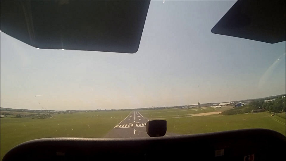
Precision Landing
The goal is to touch down on the numbers and have it stopped by the Charlie exit from the runway.
On final approach I was doing everything to make sure we would land on the numbers, so much so that it needed a bit of throttle as we came over the displaced area of the runway. Not as great as I’d have liked, but as we crossed the big “23” the wheels touched down.
I now had 1,500ft available to get it stopped in order to meet the criteria of a ‘precision landing’ : Having it stopped by Charlie. Unless I did something stupid with the brakes now, we were golden.
Aborted Take Off
The examiner called up the Tower and asked for permission to backtrack on the runway for an aborted take off.
I opened the throttle and had it fully open for a handful of seconds before I just about heard
T’s and P’s are in the Red
It took about half a second for my brain to click that he was declaring a simulated emergency…….close the throttle, get it stopped and as the speed comes down start applying the brakes.
The End Result: PASSED.
Saving me a tense walk back, the examiner told me after shutting the plane down that I’d passed.
We could go through the details inside, but this was more than enough for me.
I’m going to be honest, with the examiner gone, I found myself sat in the plane having a bit of a ‘end of Memphis Belle moment’. Nothing like the same, but I found myself looking at the controls of G-SHWK and being beyond thankful for the great flight it’d just given me.
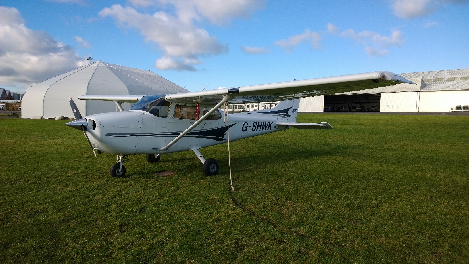
G-SHWK : End of Skills Test
Debrief
A few points, surprisingly and pleasingly few actually.
- The PFL as I’d expected wasn’t brilliant, but it had been enough to be questionable and so I’d got another go. Otherwise it could have been a fail, I was encouraged to keep doing them every flight, for if I ever need to pull this trick out of the bag, it will have to be perfect.
- The Precautionary Landing should have had a 3rd circuit, 50ft above the virtual ground.
- The Steep Gliding Descent, was safe, but the examiner would have preferred to have seen this done at 70 knots instead of 80.
If there was more I can’t remember them, I doubt anyone does it perfectly without comment and I’d take those comments happily and accept them all without question.
A lot of signature signing and large chunk of cash was all that remained. For anyone who reads this thinking about learning or in the middle of learning to fly, the skills test is an expensive day in flying. This day in history cost me a touch over £600……….but consider it this way, you’ll have put in about £10,000 to get here.
Smile, you’re almost legal to go flying on your own 🙂