Fly when the sun shines and it couldn’t have been a much nicer day to do Solo Nav #2.
The only complication really being that the wind was the “wrong way round”, in that this route required a departure from Six Mile Bottom (South East of the air field), but with a surface wind of 090 degrees, 7 knots: Runway 05 was in use – thus a departure to the North – not exactly ideal!
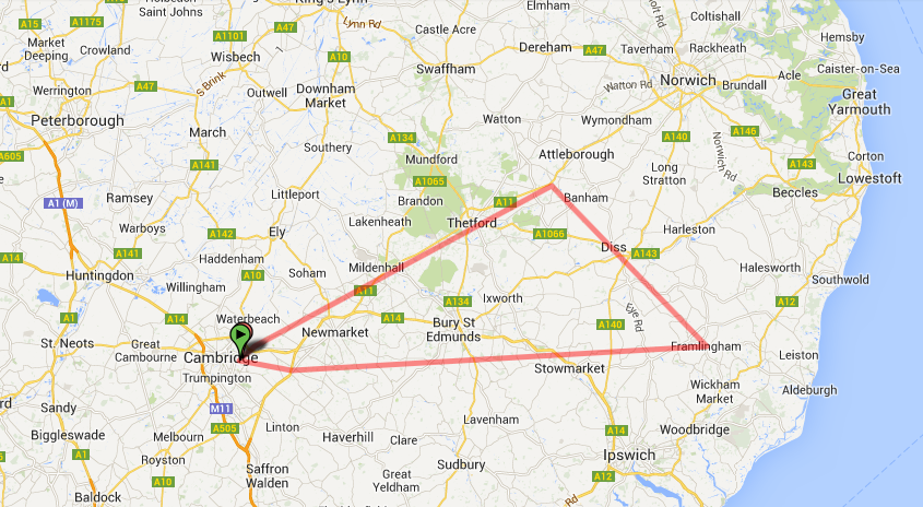
Solo Nav #2: General Route
The dilemma, take off to the north and then what?
- Turn right and fly south? (Effectively flying in the circuit).
- Turn left, climb and then fly south (In theory departing via the overhead)
I was concerned about doing the former, if I did this at what altitude should it be flown?
- Climb into the circuit height and depart from the end of the downwind leg?
- Turn and climb above the “Normal” (GA) circuit height and then fly downwind?
- Perhaps turn and fly out of the circuit rectangle and then fly south?
The latter sounds in theory the better choice, turn and climb above the ATZ, point plane for Six Mile Bottom, what could go wrong? You’re above the ATZ so limited risk of traffic problems & banging into something in the circuit. This all sounds great, but I’d urge you to remember that at this point I had 50 hours total in the log book, departures on 05 I could probably count on one hand, with the other hand I could count the total times I’d headed to six mile bottom and combining those two things (or an “overhead departure” for anywhere for that matter): Zero.
You might feel an urge to point me at PPL Book 3, Nav 76 (Departure Procedure), you’ll find limited words of wisdom there and actually vagueness and “it varies”.
So I formulated a plan in my head to go with the former and turn right on the climb out and then fly south in the circuit. I was conscious this might upset ATC, I was hopeful that they knew this was a Student Solo Nav and would be forgiving if it was wrong and my rationale for doing it went like this:
- If I fly the circuit, at worst I’m going with the flow of the traffic – I should be able to see them, they should see me. Sounds like a good safe option.
- Climbing above the circuit would be stupid, it might be a 1,000ft circuit for General Aviation – but Jets fly a 1,500ft circuit and helicopters a 600ft circuit. I want to be well clear of both of them……if it turns out to be stupid, to any other GA fixed wing aircraft it should look fairly normal, at least to begin with.
- Worst case it’d be hard for ATC Tower to not be visual with me so if it was stupid, at least I’d be doing it wrong in front of them, instead of behind and above them.
- Stick with what you know – there’d be enough new things today without needing to complicate the event further by trying to find somewhere you’ve rarely found before in whole new interesting ways (getting lost 50 miles out is one thing, but it’d be simply embarrassing to get lost 5 miles from the airfield).
Clear for Take Off
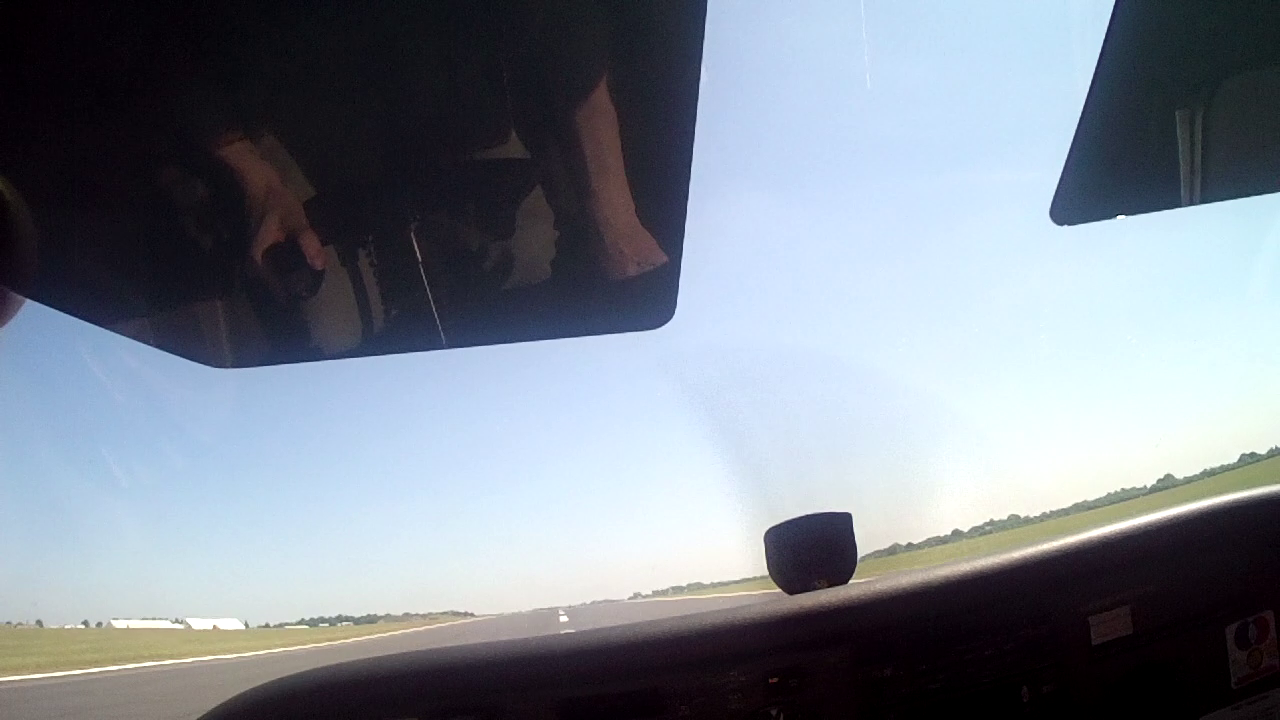
Lined up Runway 05
Not a cloud in the sky, it never gets old to line up on a mile long runway with nothing but a blue sky calling out ahead of you.
The wind being 090, 7 knots. We can do a very quick check of the crosswind by using the clock system.
Take the difference between the Runway direction and the wind direction (e.g. 90 – 50 = 40). Now imagine a clock face, if the difference is 30, then your crosswind component is approx. half the wind speed, 45 it’s three quarters and anything approaching or exceeding 60 assume 100% of the wind, you’re essentially are at 90+ degrees to it and you’ve got the wrong runway today 🙂
So for example, today:
- Wind from 90 Degrees – Runway direction of 50 Degrees = 40.
- 40/60 = 0.666 or two thirds.
- 7 knot wind speed => Two Thirds of that = Approx 4.5 knots.
Do the math completely and it quickly tells us that our quick and crude method is pretty much on the money, coming out at 4.4 knots crosswind. Our crude method is a little pessimistic, but that’s no bad thing and the error is very acceptable.
In a very quick calculation we know crosswind is well within student limits of 10 knots crosswind and the take off shouldn’t be too much of an issue – but at the same time it ain’t all straight down the runway.
Finding Six Mile Bottom : Altimeters & Human Factors
Nobody started shouting down the radio so I think we got away with the departure, a quick call to state intent of departure to ATC seemed to keep everyone happy.
It shouldn’t have been a relief to find the railway that leads to six mile bottom, but it was.
Just beginning to settle down, I knew where I was, I was bugged up for the first heading and now talking to Cambridge Approach I’d just stopped the climb and beginning to level out when they called with an interesting query
What Altitude are you climbing to?
Without a second thought I started my reply “…remaining at………” a glance again at the altimeter showed a classic human factors error. The dial actually said 1,500 ft, not 2,500ft. Ever wanted to know the benefits of the “Student” prefix, here’s proof. ATC lending a little helping hand of verbal assistance perhaps 🙂
Nice easy flight to Framlingham
I find that a few minutes in the nerves fade away and you start to fly better and perhaps more as trained.
Stowmarket was nice and easy to find and Wattisham Approach were friendly enough and gave us MATZ penetration without any issues.
Framlingham being as far east as I’d ever have flown on my own, I’d done my homework before taking off. A little bit of Google Earth goes a long way once you’re up in the air. Ironically I totally missed the fact that Framlingham has a massive Castle to its north east, I never ever saw this at all. What I knew it had, was a big ‘lake’ / pool of water to its north and I used this as the key reference to identify it as being Framlingham.
Diss and Snetterton
Wattisham were ahead of me and called up to ask where I was routing next, before handing me off to free call Lakenheath, another Military ATC. Usually there and usually sounding very much like you’d imagine military air traffic controllers to sound.
Student Golf Hotel Echo Romeo Charlie Squark Zero Four Five Six, MATZ Penetration approved
Diss is easy to find, it has a great big railway and an even bigger industrial site around that railway so from the sky it stands out – it’s as if someone thought about this route and good places to send students on their first attempts at seriously spreading their wings 🙂
Sadly there was no racing on at Snetterton, so I didn’t get treated to any overhead views beyond that of the race track itself – maybe next time.
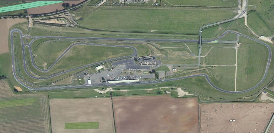
Snetterton Race Track
The final leg of the trip, Snetterton –> Cambridge emphasizes the need for precision heading holding relative to previous legs.
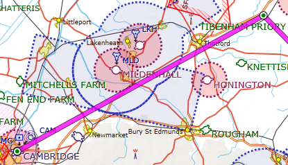
Snetterton -> Cambridge Airspace
As you can see from the airspace chart, the plane has to be flown between Honnington ATZ and Lakenheath/Mildenhall CMATZ, with real vigilance required for avoiding flying into Mildenhalls ATZ
However the ATZ stops right on the A11, so as long as you keep that road on your right – you know you’re safely out of their air space.
Other than that, it was just a run in the sun.

Nav 2 Cockpit with Map
Amazing visibility, not a plane in the sky and the navigation was all going beyond my best expectations. For seemingly so few trips out with instructors (4 duel nav’s), it’s amazing to think how quick you pick all this up and begin to find your own way around.
All that was left to do was get the ATIS for Cambridge, hand over from Lakenheath to Cambridge Approach and rejoin the circuit.
Slightly easier said then done, on return to Cambridge there was a real chatter of people talking and replying on the frequency. Few things are more frustrating then being 6 miles out with a pilot in the ATZ waffling on instead of keeping to the specifics of what they want/need. It was no good, I elected to orbit to avoid entering the ATZ while waiting for the call back and forth and the “say again…” to stop.
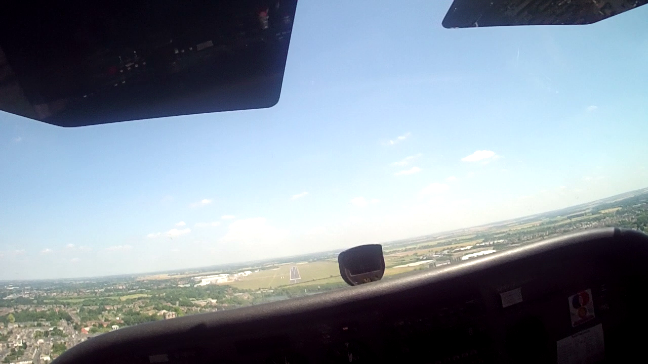
Runway 05: To Land.
The runway in sight, we were home from our joy ride out over East Anglia.
As I was lining up on the runway another plane flown by a woman who’s radio calls put the other guys waffle to shame, was joining up behind me.
Landing Runway 05
Lined up for the runway nicely, the wind being a fairly calm 30 degrees, 8 knots (So a mere 3 knot crosswind component, well within student limits, it doesn’t get much better).
A positive touch down, no bounce but I’d have liked to have done it with a touch less of a thud on the back wheels.
To get me out of the way of the plane behind me I was told to exit at “Mike” (at an airport this big you never cease to be asked to do new things – but it’s good practice for the future).
Solo Navigation #2 : DONE!
Had an awesome time, once out of the ATZ not a thing went wrong and I truly enjoyed this flight out. The sun was shining, the views were great and ATC friendly as always. It’s starting to come together and with a 90+ Mile solo flight out of the way, perhaps I’m beginning to get the hang of this flying 🙂
No turning back now, Qualifying Cross Country (QXC) on the horizon!!!!