This was a trip out to the clubs standard ‘first land away’ location: Peterborough Connington
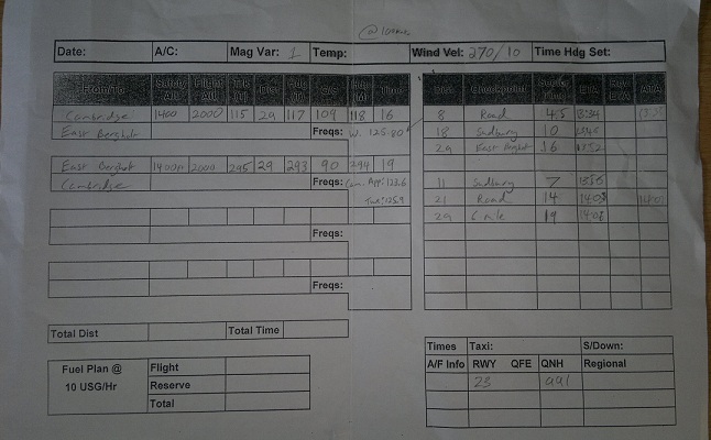
There’s not much time on land aways, so the aim is to get there early – perhaps when they say early, they mean more than 10 minutes to spare :-\ The world was against me this morning, so best laid plans to be there with a clear 30 minutes of margin got shot to bits…….still my flight log had it as ~24 miles of nav. How much free time do you really need?? Apparently, lots!
Things to do:
- Check my flight planning
- Go through the briefing for landing away
- Phone Peterborough Connington and get Prior Permission.
- Reminder on Additional Documents required to be carried for Land Aways
- Check the Plane
Why did you Plan that Route?
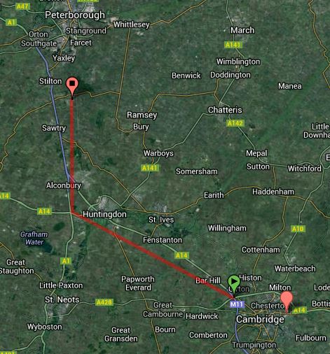
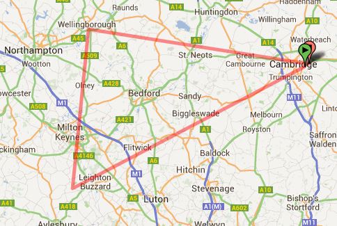
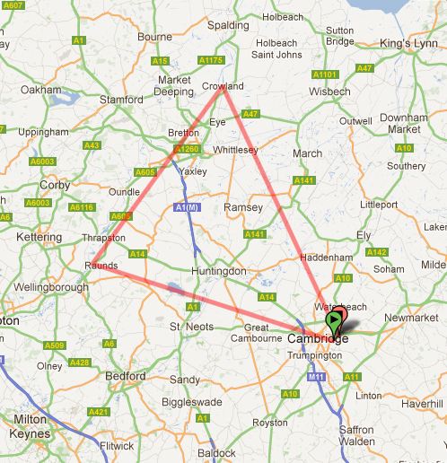
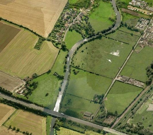
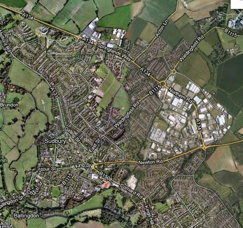
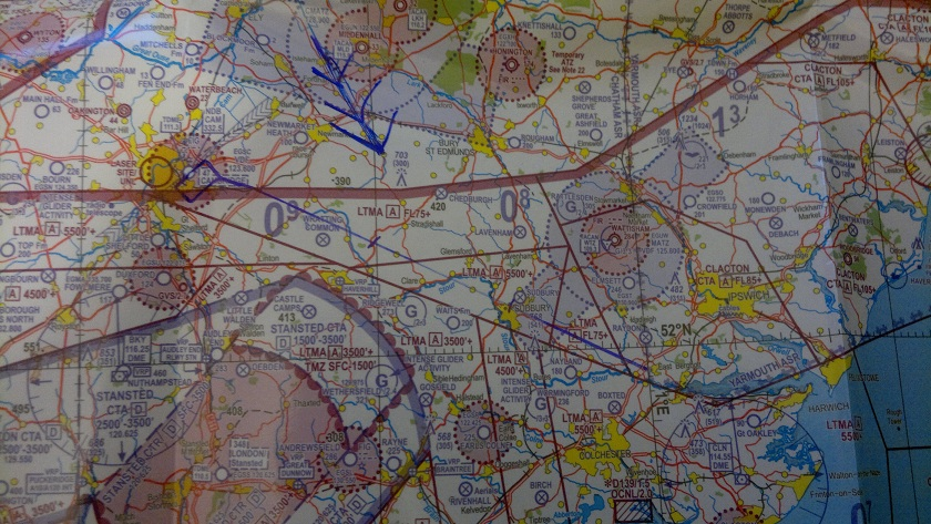
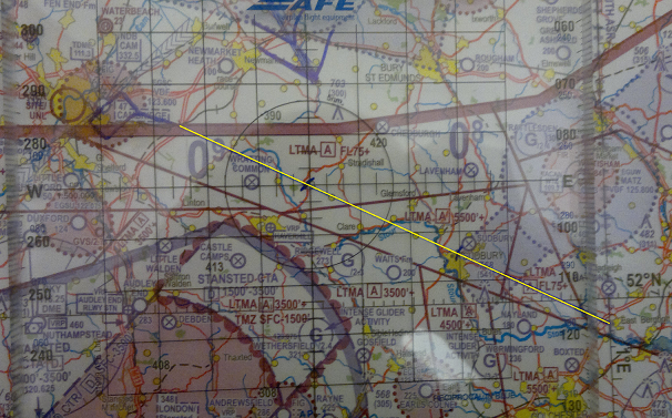
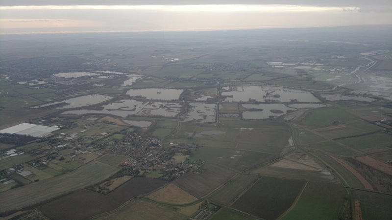
Cambridge to Connington General Route
I’ve marked up the general route I had planned to fly on the right, it’s not rocket science to notice that my plan of attack was to fly along the A14 and then turn right and follow the A1. Straightforward enough.
Of course you can fly Cambridge to Peterborough Connington direct. This way is about 2 nautical miles shorter, but you’ll have to fly over RAF Wyton’s ATZ, the route will take you within 2 miles of Upwood Glider site who are capable of launching to 2,100ft and your approach direction is not ideal for a standard overhead join, given the airfields main runway is on 100 degrees magnetic. So all things considered I’d decided those 2 miles of distance weren’t worth the hassle and had planned it up for a route that would be near impossible to get lost.
Speeding up the Checklist
With prior permission obtained and the report from the airfield that the weather was all good there. Nothing left to do but grab the bag with the POH and other documents in and get going.
My instructor raced through the startup procedure to save time – this is a gift and a curse, as it does leave you trying to remember what’s been done and what hasn’t as it’s now all out of sequence.
The climb out was good, now just a matter of getting to point alpha and starting the clock.
Turning over Huntingdon
My map suggested that the first big roundabout we got to, we needed to turn right and head north. The clock seemed to tie up with a roundabout that looked correct, so I turned north.
Fairly quickly I started to piece together that I’d turned too soon, the big give away was the fact we had the dissused airfield of Alconbury on our left. The flight plan said it should be on our right. We also should now be tracking parallel with the A1 but it was a good few miles out to the left, clearly I’d turned on the wrong roundabout.
Not a massive problem though, Alconbury is dissused and there was no reason we couldn’t correct the track onto the A1.
With that out of the way, time to call Cambridge Approach and switch over to Peterborough Connington Radio. They knew we were coming, so they sounded quite expectant and welcoming to hear our call sign.
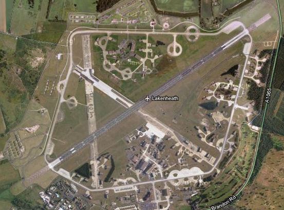
Peterbourgh Connington: In Sight
The map said we were near and my instructor had said “Let me know when you can see the airfield”, so I knew it was out there. A few seconds later, the fairly unique sign long straight strip of concrete of an airfield appeared, that would be Connington then 🙂
Their radio operator informed us they were on active runway 10, left hand circuit.
Few things to think about given this information: Firstly it means the circuit is flown with only left hand turns, for a runway on 100 degrees magnetic, this tells you that the “active” side of the runway is on the far (north) side of the runway. So we’d need to overfly the airfield at 2,000ft above ground level, turn back on ourselves, overfly at 2,000ft again and then descend on the dead side (south of the runway), before joining the circuit at 1,000ft above ground level and performing the series of left hand turns required prior to landing.
It’s a fairly busy little airfield and today was no exception with a good few planes in the circuit or about to join behind us. The other minor complication being that they have noise abatement here, so you have to try and avoid directly overflying the village to the north (I like hearing & looking up at planes, but I can appreciate that not everyone does…..especially if it’s all day long).
Generally speaking I was quite happy with my circuit considering I’d never flown a circuit in my life away from the hugeness of Cambridge.
You call that a Runway!?!?!
Ok, I totally accept that for most people learning to fly, Connington is possibly as good as or better than their airfield. It’s got a concrete runway for starters courtesy of when it was built in the 1940’s by the 809th US Army Engineers.
That being said, the main runway is 23m wide, now remember that I’ve flown more circuits than I can remember, but every one of them has been flown at Cambridge and good old EGSC’s runway is 46m wide, I’ve never tried landing using only one side of the runway before! 🙂
All that being said, the landing was quite nice, a touch flatter than I’d have liked but all in all gentle enough – before being bumped about by the less than smooth runway (I now appreciate how high my standards are for runways!).
Just a matter of taxing down to the far end and parking up amongst the million (well ok 10 or so), other aircraft – it felt like a million, there wasn’t a lot of maneuvering space.
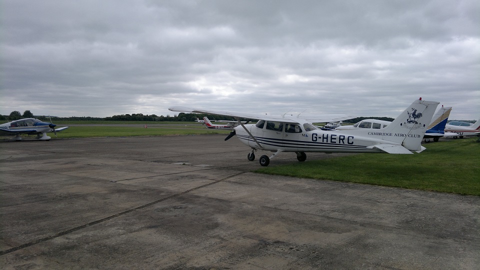
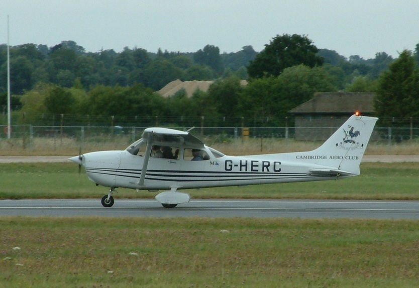
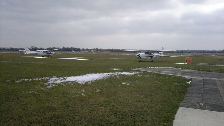
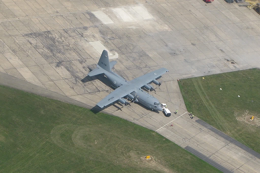
G-HERC Parked up at Peterborough Connington
Welcome to the next problem that I’ve never experienced before, the apron was packed with planes, so it was a case of carefully squeezing past them and being very careful to keep an eye on where walking humans were. Hi-Viz appeared to be optional.
Very little time to enjoy the sights though, it had been a rush to get out here, now there was just time to have a stroll around the outside, a quick look inside only to find a bar and club atmosphere that would arguably make even Cambridge jealous. Still there was no time to soak any of that up, time to pay our £10 landing fee for the privilege of stopping (and to be fair the services of a very helpful ground to air radio operate, much thanks!). Then it was a case of a dash for the plane and lets get out of here.
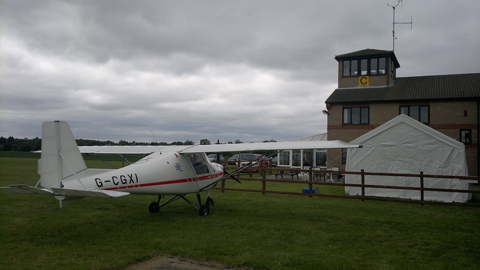
Peterborough Connington Club Entrance
Without the mass procedure of a big airfield, starting up again was more like a simple matter of checking the oil & fuel, jumping in and starting the engine. Taxing out wasn’t far behind in its simplicity: No requests for clearance here, just a statement of fact that we were. Of course as the radio service here is essentially just that, they cannot clear you to taxi as they’re not a control service. After over a year of asking for permission, it’s weird & feels almost wrong not to.
However, with no taxiway to the far end of the runway, it was a very long back-track down the runway before turning it around ready for a take-off.
Final checks done and a right hand turn out discussed, it was full power and off we charged down the runway. You could feel the difference a smooth surface gives for speed relative to this pot holes run.
Turning right my navigation, which would now be complicated if I’d plotted a direct route, couldn’t be simplier: Turning climb out to point at the A1, then when you hit the A1 turn left and follow it all the way to Huntingdon. From which you can set a course for Cambridge and start the clock.
A few words of thanks to the radio operator as we departed their ATZ and pretty soon it was a matter of switching over to Cambridge Approach.
Messing up the Landing
Back at Cambridge the runway in use was 05 (right hand), that would make rejoining complicated. Coming in from the West, if we had to do a standard overhead join, it would mean flying over the 23 numbers @ 2000ft, turning around, flying back over the 05 numbers, descending dead side and then doing a full circuit. That takes time and money to do…..so I thought I’d try my luck by asking for a pretty non-standard “Left Base Join”.
Essentially a left base join is asking to come in from the wrong side of the circuit and turn left (when all other traffic would be doing right turns), straight into the base leg and on to final approach. To have any hope there’d have to be basically nothing in the circuit.
As is so often the case Cambridge ATC were awesome and entertained my request.
I’d go and let them down a little by turning a nice enough approach into a bounce on the nose wheel! Hmm the last 75ft went wrong there, in hindsight I could have gone around but in the second(s) where I was beginning to think about doing that the ground was already with me. Damn…..had to mess it up on the nice big runway didn’t I, this is what you get for focusing on landing as soon as you can, rather than as nice as you can.
Still, back in once piece and finally something other than EGSC in the log book.